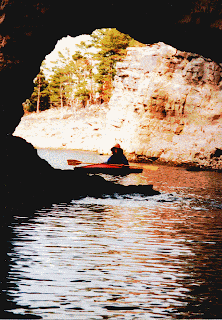
Below is some basic information taken from the web. There is also a good article on the lake in Wikipedia:
"About Norfork Lake
Norfork Lake, a popular tourist attraction in North Central Arkansas, is also one of the major recreation centers for this area. Norfork is home to one of the largest Federal trout hatcheries east of the Rockies, and is renowned for its rainbow trout. Over 550 miles of shoreline surround the lake along with 20 developed parks, which make Norfork popular for boating, hiking, hunting, sight seeing, skin diving, swimming, and water skiing.
Norfork Lake was formed with the construction of the dam which was initiated in 1941 and completed in 1944. Norfork Dam lies on North Fork River, at river mile 4.8, which is 4 miles northeast of Norfork, Arkansas. Completion of the powerhouse and switchyard came in October 1949, while in 1944, commercial generation first began. Estimated cost of the complete Norfork construction project was $28,600,000.
Norfork Lake is one of four multiple-purpose projects constructed in the upper White River Basin for the control of floods and the generation of hydro electric power. As with the other three projects, Norfork also provides excellent recreational opportunities for people of all ages.
Norfork Lake consumes anywhere from 22,000 to 30,700 acres depending on water height, and has a maximum depth of 177 feet above the dam. Tributaries include Norfork River, South Brushy Creek, Big Creek, Pigeon Creek, East Pigeon Creek, and Bennets Creek. Water exiting the dam into the North Fork River, which then flows into the White River. Average elevation at the dam is 590 feet, while fluctuations vary from 6 feet low to 30 feet high.
The 550 miles of shoreline consists of limestone bedrock and gravel. Wildlife abounds in the surrounding area making hunting very popular. The lake provides fishing opportunities for almost all species of game fish, with especially good fishing for black bass and a renowned reputation for largemouth bass. The lake does not have a closed season and never freezes over in the winter.
Length of dam - 2,624 feet
max height above streambed - 216 feet
Cubic yards of concrete in dam - 1,500,000
length of spillway - 568 feet
spillway crest gates (12) - 40x28 feet
Outlet conduits (11) - 4x6 feet
Elevation of top of dam - 590 feet
Elevation of spillway crest - 552
Elevation of top of flood control pool - 580
Elevation of top of conservation pool (Sept. to April) - 550
Elevation of top of conservation pool (April to Sept.) - 554
Surface area acreage at top of flood-control pool - 30,700
Surface area acreage at top of conservation pool - 22,000
Storage capacity at flood conrol - 732,000 acre feet
Storage capacity at power drawdown and dead - 1,251,000
Storage capacity of total lake - 1,983,000
Shoreline at flood-control pool - 510 miles
Shoreline at conservation pool - 380 miles
2 generators installed, each generating a max of 35,000 kilowatts
Room for 2 more generators
Construction of dam started in spring of 1941 and was completed 3 years later. Construction of the powerhouse and switchyard was completed in October 1949. Commercial generation began in 1944. Total cost - $28,600,000."
No comments:
Post a Comment