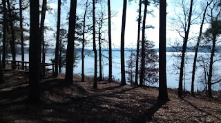
Start your hike by parking near the gate across the entrance to the park. You'll warm up nicely on the lovely wide pavement that takes you down to the campsites. Near the southwestern end of the paved road, there is a short hiking trail that leads to a lovely bench overlooking the lake. This is rated as an easy hike. Total distance -- 2.5 miles with only 355 feet of climbing.
Click here to see an interactive map with elevation profile from Strava.
Click on this link to open the map in Google Maps. To use the Google Map as you hike, you should install Google My Maps on your phone and download a map of the general area before you hike. Here is how to do so.


No comments:
Post a Comment